The Ryesong River in North Korea, which recently sparked controversy due to its absence from domestic mapping services, is now correctly displayed on the official national mapping service.
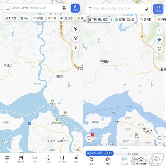
In the wake of this controversy, Kakao Map has updated its maps to include the Ryesong River, while Naver Map still does not show it. Naver stated that there was no intentional deletion or modification and plans to update its maps with the latest data that include the Ryesong River.
South Korea’s Official National Internet Map Now Displays Ryesong River Amid the Deletion Controversy
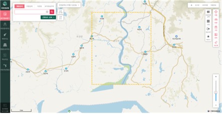
On Tuesday, Rep. Choi Soo-jin of the People Power Party, a member of the National Assembly’s Science, Technology, Information, Broadcasting, and Communications Committee, received a report from the National Geographic Information Institute (NGII) during the national audit. The NGII confirmed that the Ryesong River is currently shown on its video maps created using satellite imagery, 1:25,000 scale topographic maps, and the national internet map.
The NGII’s national internet map serves as South Korea’s official mapping service and is the standard mapping platform used across both public and private sectors.
All central administrative agencies and local governments are required to adhere to the coordinate system and standards of the national internet map when creating mapping services or geographic information systems (GIS), as mandated by Article 18 of the Enforcement Decree of the National Spatial Information Act.
Consequently, domestic public services display asset, facility, and disaster data on the national internet map. Private companies like Kakao are also known to build their mapping services based on the national internet map’s data.
Kakao Map has stated in its Legal Notice and Information Provider Guide that its mapping service is based on data from the Ministry of Land, Infrastructure, and Transport as well as the NGII. Naver also signed a memorandum of understanding with the NGII in May to collaborate on developing high-precision maps.
Kakao Updates Ryesong River on its Map; Naver Plans to Incorporate the Latest Data
Currently, Kakao Map displays an image of the lower Ryesong River near Pyongsan County in North Hwanghae Province.
Until early July this year, Kakao Map did not show the Ryesong River, leading to allegations of intentional deletion. This controversy arose after suspicions emerged that North Korea’s uranium enrichment facility was discharging radioactive wastewater into the West Sea via the Ryesong River, raising concerns about potential government interference.
In response, Kakao explained that it regularly updates regions within South Korea by aggregating and processing data from various information providers. However, it faces challenges in obtaining sufficient data and making timely updates for areas outside of South Korea. The company stated it would review updates in consultation with relevant authorities as needed and subsequently updated its maps.
In contrast, the lower Ryesong River still does not appear on Naver Maps. Naver had previously stated that there had been no intentional modifications to its map.
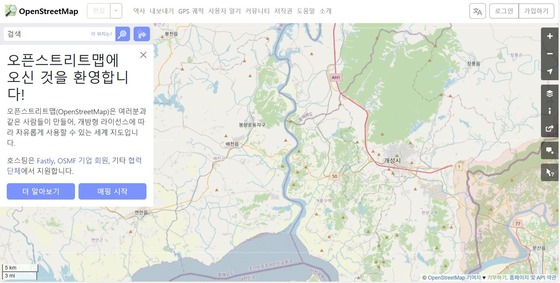
Naver provides maps of overseas regions, including North Korea, based on OpenStreetMap (OSM) data. OSM is a free mapping service that allows users worldwide to directly edit and manage maps. While some specific regional details may be missing or contain errors, the lower Ryesong River currently appears correctly on OSM.
Naver explained that it only updated its North Korea regional data in 2021 and 2023, during which some information may have been omitted from the map data used at that time. Since the latest version includes the Ryesong River, the company plans to update its map accordingly.
A Naver representative stated that it plans to incorporate the latest version of OSM data into the maps.
Meanwhile, the government conducted its first joint investigation on July 18 in response to public concerns over allegations regarding North Korea’s uranium facility wastewater. On October 19, they announced that three months of regular monitoring had confirmed no abnormalities.
Rep. Choi emphasized that since the national internet map, which is fundamental to both public and private mapping, accurately displays the Ryesong River in North Korea, it is essential to transparently disclose this information to prevent any suspicion of intentional deletion.